
Site Map
See exactly where the proposed development is located and how it relates to the surrounding countryside, roads and community.
Where Is The Site?
The proposed development site is located north of Cockreed Lane on the northern edge of New Romney. The site sits adjacent to existing housing and forms part of the transition between the town and the surrounding countryside.
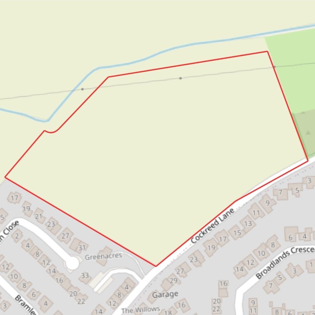
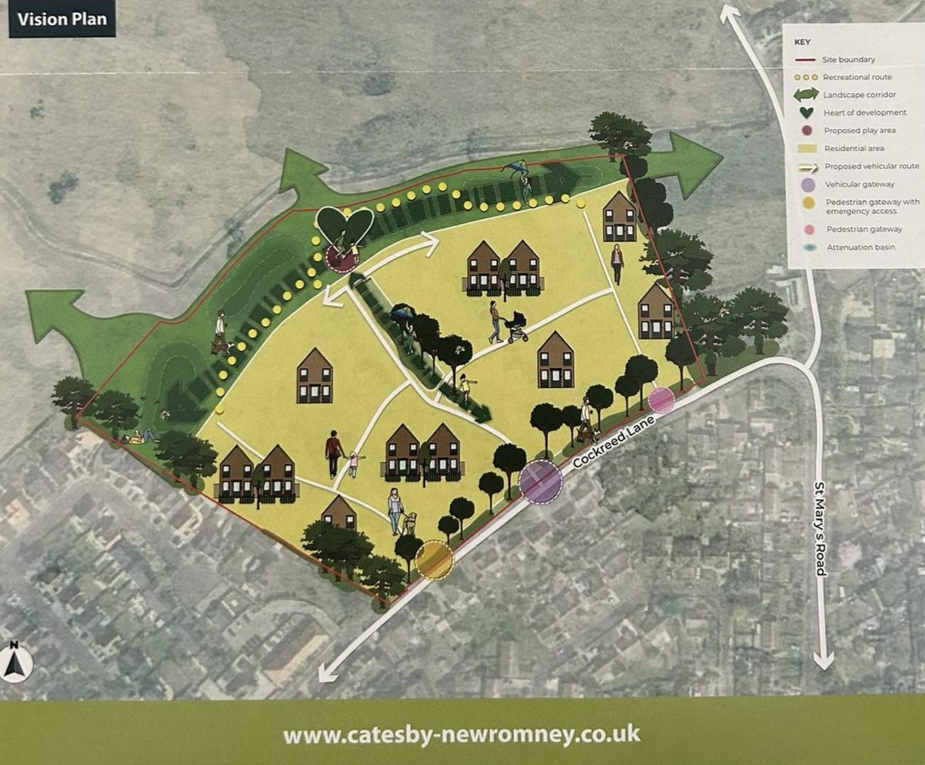
More Than Just A Location On A Map
At first glance, this may appear to be just another development site. In reality, the location of the proposed development lies at the heart of the debate.
The site sits at the point where New Romney meets the surrounding countryside. Any decision made here could influence not only what happens on this land, but also how residents view future growth around the town.
That is why understanding the site’s location, boundaries and relationship to the wider area is so important.
Get Involved
Add your name to our petition and help demonstrate the strength of community support.
Every donation helps us raise awareness, share information and support the campaign.
Have information, photographs or local knowledge that could help the campaign? We’d love to hear from you. Get in touch with our team today.